AI · land monitoring
Detecting change with foundation models
A series of Sentinel-2 or Sentinel-1 images over a site, a foundation model used as is, and the distance between dates to spot what changed. The application is being tested east of Nairobi (2024-2026).
Expertise France · 2026
Who it is for
Intended for monitoring a specific site: urban sprawl, clearing. The only case tested so far is urban sprawl east of Nairobi.
What the application does
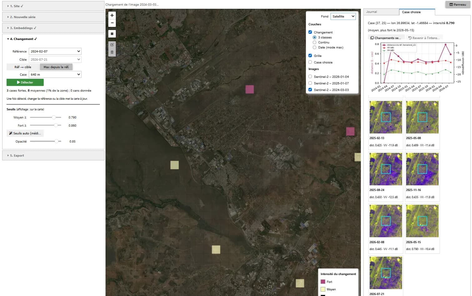
Change map
Intensity per cell (160 m to 2.24 km) between a reference and a target date, in three classes. Default thresholds: median + 3 and + 6 robust standard deviations, adjustable.
Date of change
For each cell, the largest distance since the reference and the date it is reached.
Cell history
On click: distance curve over the whole series, NDVI and NDWI (VV and VH for radar), thumbnail of each date. Optionally, the cells whose change resembles that of the selected cell.
How it works
01
Image series
One date per period on the same 10 m grid: for optical, the date with the most usable pixels according to the scene mask; for radar, a median composite from a single orbit.
02
Embeddings
One vector per patch (80 m for Clay, 160 m for TerraMind) and per date, frozen weights, on GPU. A no-AI baseline, mean and standard deviation of the bands, serves as control.
03
Distance and thresholds
Cosine distance between two dates after centring on the series, averaged per cell. Most cells do not change: their median and spread set the thresholds.
Known limitations
- Not validated yet: no comparison with known changes.
- Unmasked clouds or haze, different seasons, fires and crops cause false changes, to be checked on the cell curve before concluding.
- With radar, speckle and a different number of acquisitions per composite can create a false change everywhere.
Going further
- Validation on dated changes (new housing estates, clearing)
- Quantified comparison with the no-AI baseline
Role
- Application design
- Detection method
- Development and GPU testing
Technologies
PyTorch · TerraTorch · Clay · TerraMind · Sentinel-1 · Sentinel-2 · STAC · ipyleaflet · Voilà
Context
Demonstrator designed and built in 2026 by Guillaume Rieu, author of the Earth Innovation Labs specifications, as a volunteer contribution to the acceptance testing of these platforms in Kenya for Expertise France. It runs in the platform's JupyterHub environment.
A similar need?
These demonstrators can serve as the basis for a tool adapted to your data, your area or your question.