AI · very high resolution imagery
Detecting buildings, vehicles and boats in very high resolution imagery
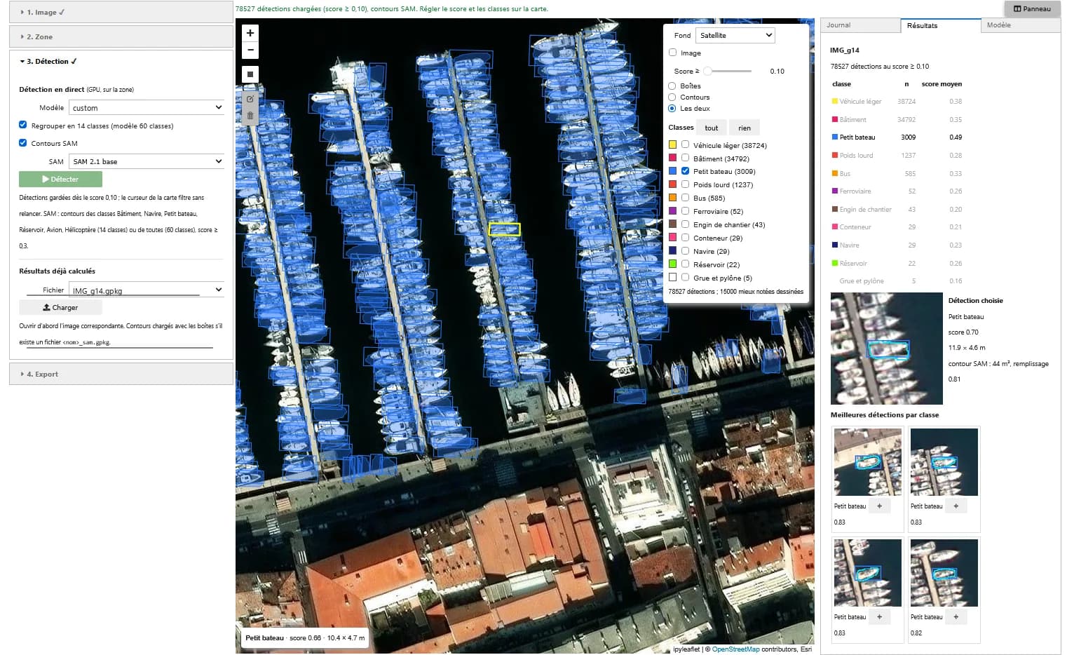
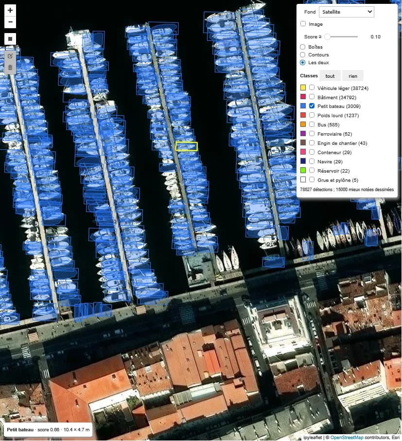
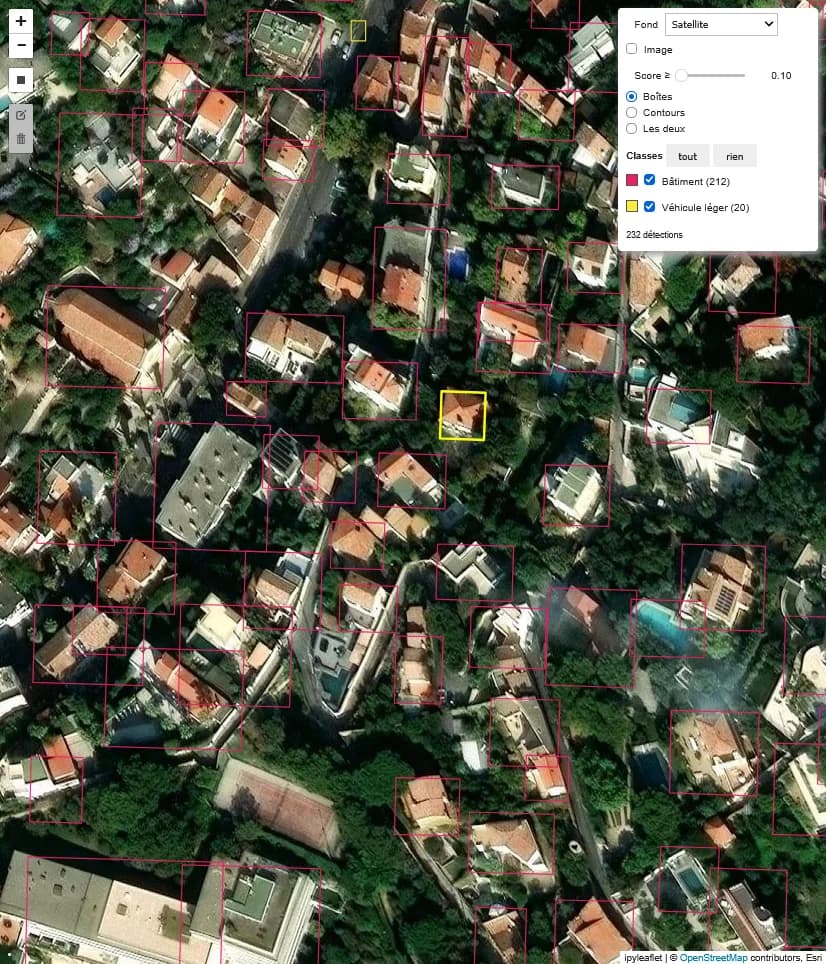
A YOLO detector trained on xView (30 cm images, 60 classes), applied to another very high resolution satellite image. Detections are grouped into 14 classes, six of which are outlined with SAM.
Expertise France · 2026
Who it is for
For counts and inventories over large areas (buildings, vehicles, boats), to be checked before any official use.
What the application does
Detection over an area
Rectangle drawn on the image, up to 10,000 x 10,000 px, detection on GPU and grouping of the 60 classes into 14.
SAM outlines
SAM 2.1 outlines buildings, ships, small boats, storage tanks, aircraft and helicopters, with their area.
Filters and export
Minimum score, displayed classes and counts without re-running. GeoPackage and CSV export.
How it works
01
Data
xView: 30 cm WorldView-3 images annotated in 60 classes, cut into 640 px tiles. Validation on 10% of the scenes, as the official validation labels are not public.
02
Training
YOLO (Ultralytics) on GPU, saved at every epoch and resumed after an interruption.
03
Detection
640 px tiles with 20% overlap, merged detections, then SAM outlines from the boxes.
Screenshots
Known limitations
- Imbalanced classes: buildings and small cars dominate, rare classes are detected less well.
- Model trained on WorldView-3 and applied here to another 30 cm image, with no performance measured on it.
- Axis-aligned boxes, poorly suited to long oblique objects.
Going further
- Oriented boxes for ships and aircraft
- Fine-tuning on local imagery (drone, Pléiades Neo) with a few annotations
Role
- Data preparation
- GPU model training
- Demonstration application
Technologies
PyTorch · YOLO (Ultralytics) · SAM 2.1 · xView · GeoPackage · ipyleaflet · Voilà · GPU
Context
Demonstrator designed and built in 2026 by Guillaume Rieu, author of the Earth Innovation Labs specifications, as a volunteer contribution to the acceptance testing of these platforms in Kenya for Expertise France. It runs in the platform's JupyterHub environment.
A similar need?
These demonstrators can serve as the basis for a tool adapted to your data, your area or your question.