AI · mapping
Finding similar features without training data
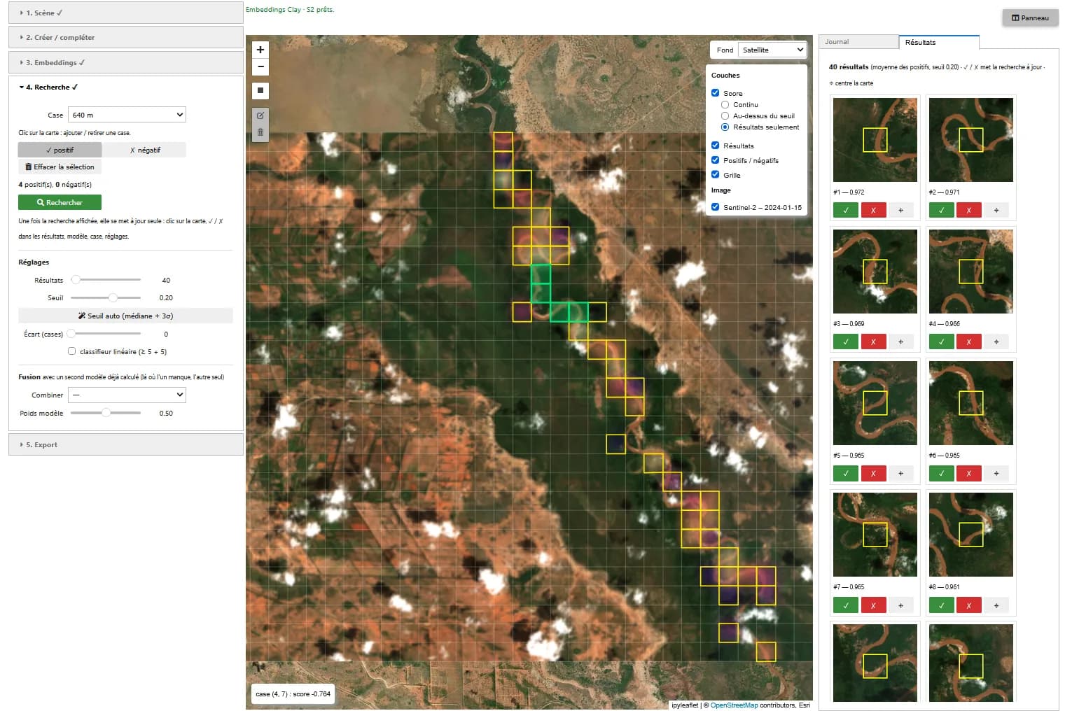
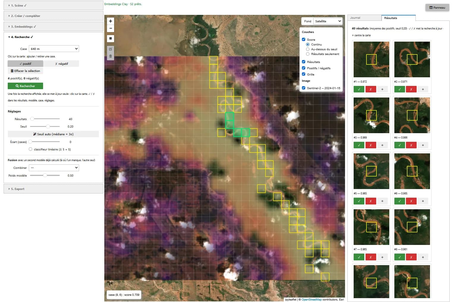
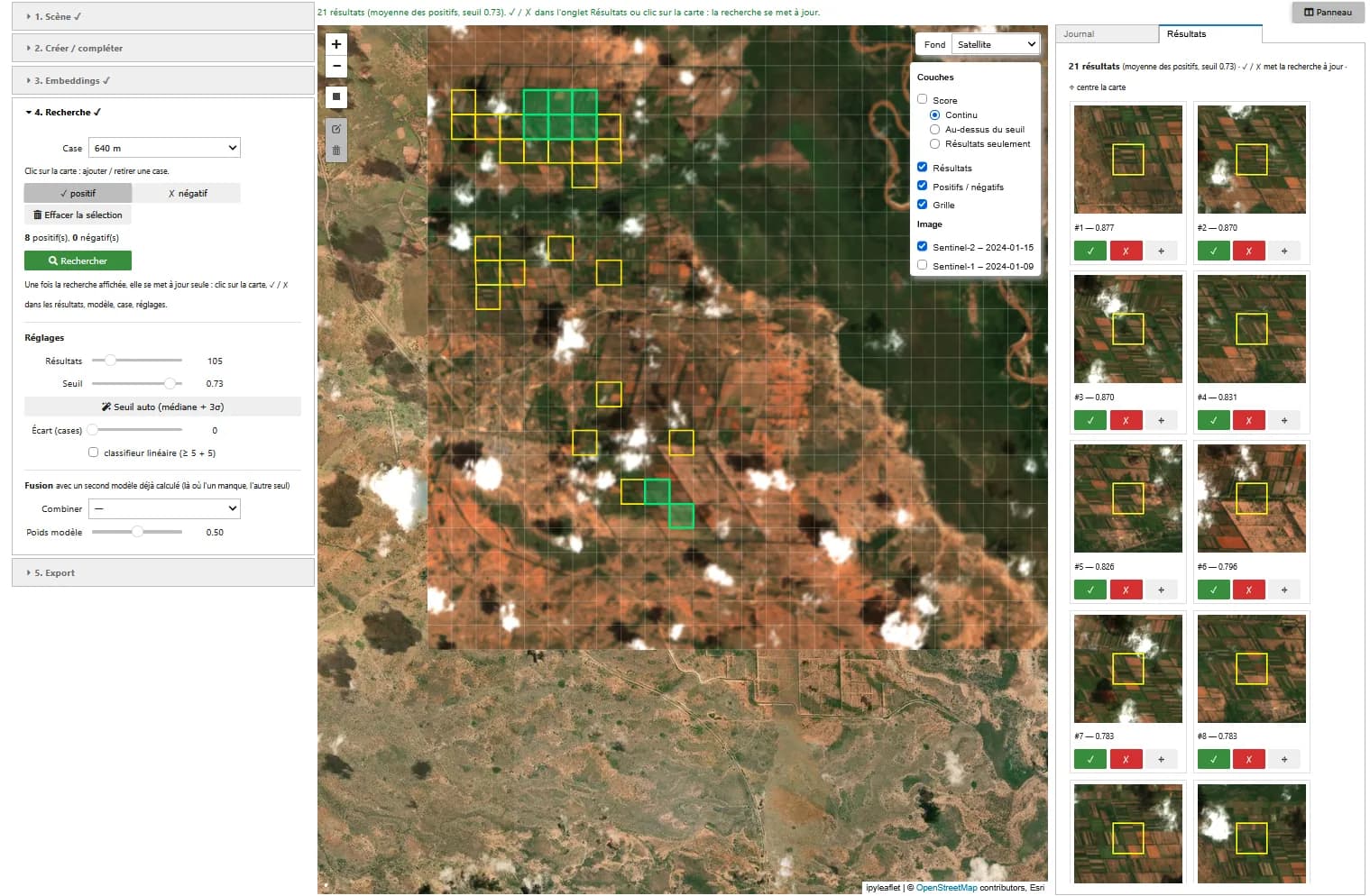
Point at a few example cells on a Sentinel-2 image; the foundation model ranks the other cells of the scene by similarity. The models are used as is, without labelling or training.
Expertise France · 2026
Who it is for
For a first screening of an area (irrigated plots, settlements, quarries, water bodies), before finer mapping or to gather training examples.
What the application does
Search by example
A click on the map adds a positive or negative cell. Once embeddings are computed, the search updates on each click, validation or setting change.
Several models
Clay (80 m patch), TerraMind (160 m) and a no-AI baseline. Two models can be combined, for example optical and radar.
Validation and export
Accept or reject each result on its thumbnail, automatic threshold, linear classifier from 5 positives and 5 negatives. GeoTIFF and GeoJSON export.
How it works
01
Scene
Sentinel-2 L2A image (10 bands) over the drawn area, and optionally the Sentinel-1 image closest in time or a radar series.
02
Embeddings
One vector per patch, frozen weights: a few minutes per model on GPU for a scene.
03
Score
Cosine between each cell and the mean of the positives minus that of the negatives. A cell is the mean of the patches it contains.
Screenshots
Known limitations
- Cells of 80 m minimum (160 m for TerraMind): the tool finds areas, not small objects.
- No quantified comparison yet between Clay, TerraMind and the no-AI baseline. For water or bare soil, the baseline may do as well.
- Cloudy cells are excluded in optical imagery. Radar avoids this but measures something else: roughness and the structure of buildings and vegetation.
Going further
- Count true positives on a few queries to compare the models
- Export validated results as training examples
Role
- Application design
- Model comparison
- Development and GPU testing
Technologies
PyTorch · TerraTorch · Clay · TerraMind · Sentinel-2 · Sentinel-1 · STAC · ipyleaflet · Voilà
Context
Demonstrator designed and built in 2026 by Guillaume Rieu, author of the Earth Innovation Labs specifications, as a volunteer contribution to the acceptance testing of these platforms in Kenya for Expertise France. It runs in the platform's JupyterHub environment.
A similar need?
These demonstrators can serve as the basis for a tool adapted to your data, your area or your question.